

Latest Weather Blog
Wednesday PM Forecast: gradual climb in humidity, rain coverage into the weekend
The next few afternoons will bring humidity about as low as you could expect for early September. It will still be hot. By the weekend, the next front will return chances for showers and thunderstorms.
Rest of the Week: The few showers that were able to develop will wane after sunset. Expect mainly clear skies with lows in the low 70s. Thursday and Friday will be bonus days of seasonably pleasant weather. Afternoon highs will warm into the low and mid-90s, but it won’t feel nearly as steamy as it usually does this time of year. Thanks to mainly clear skies and drier air, overnight lows will fall into the upper 60s to lower 70s — a refreshing change from the muggy nights we’re used to. If you have outdoor plans after work and school, including high school football, the weather will cooperate.
Up Next: By Saturday, the pattern will start to change a bit. In response to sunshine, temperatures will quickly warm out of the 70s and into the 90s. Moisture will slowly return on an onshore breeze, which means humidity will creep up and even support a spotty, afternoon shower or thunderstorm, especially closer to the coast.
For football fans, both LSU and Southern are at home this weekend. It will be hot during those tailgates. Humidity won’t be as high as last month, but you’ll notice it. Odds of a pop-up storm are low — but not impossible — so keep that lightning safe place in mind. Some leftover energy from a Pacific Ocean tropical system and an approaching front could kick out isolated showers and thunderstorms. By kickoff time, temperatures should ease into the 80s, which will feel a little more comfortable.
A weak cold front will approach on Sunday with rain coverage ticking up into the isolated category around 30%. Still, the second half of the weekend does not look like a washout, but keep an eye on the radar if you’ll be outside in the afternoon.
The forecast is not clear cut as to whether or not this front will move into the Gulf. Should it stall near the coast or inland, expect some humidity and at least a chance for showers and thunderstorms to remain possible. However, the current thinking is that the front will move far enough south to warrant a dip in humidity early next week.
Trending News
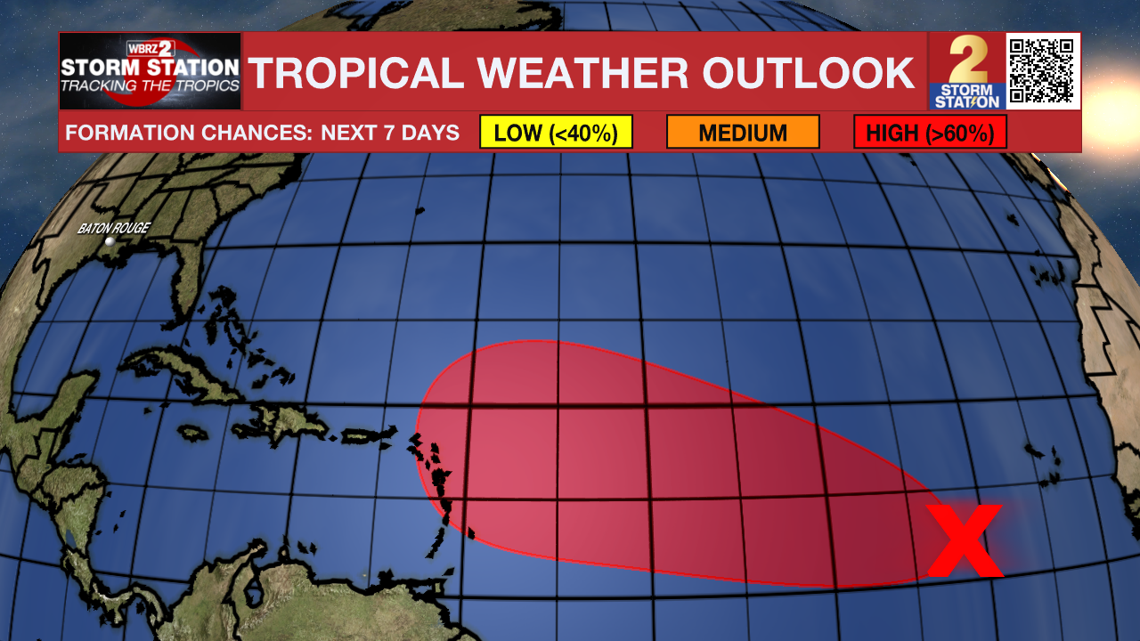
The Tropics: A tropical wave a few hundred miles west-southwest of the Cabo Verde Islands is producing disorganized showers and thunderstorms. Conditions look favorable for development, with a tropical depression likely by later this week or the weekend as the system moves west-northwest around 15 mph across the Atlantic.
Get the latest 7-day forecast and real-time weather updates HERE.
Watch live news HERE.
– Josh
The Storm Station is here for you, on every platform. Your weather updates can be found on News 2, wbrz.com, and the WBRZ WX App on your Apple or Android device. Follow WBRZ Weather on Facebook and X for even more weather updates while you are on the go.
More News
