Latest Weather Blog
As a cold front moves into the Baton Rouge Area, showers and thunderstorms will ramp up on Saturday. A noticeable cool down is expected for Easter Sunday and Monday, which will drop our afternoon highs back into the 60s.
Saturday: higher rain coverage (70%) with a few downpours
Easter Sunday: soggy start, giving way to much cooler, drier air
Next Week: cool through Tuesday morning, then warming
Tonight & Tomorrow: Look for the showers and thunderstorms to relax through the evening hours. A muggy feel will persist for one more night with low temperatures remaining in the upper 60s and even low 70s.
Saturday will feel warm and humid with highs in the 80s away from the coast. Showers and thunderstorms will be more widespread compared to Friday, especially during the afternoon and evening hours. If you have outdoor plans, especially west of I-55, stay in touch with the Storm Station WX App. There is not a major concern for severe weather, but the Storm Prediction Center has placed a large portion of the area under a level 1/5 marginal risk, as a spotty thunderstorm could produce gusty winds or hail. Rain will continue late Saturday night into Easter Sunday morning as a cold front pushes through. Lows Saturday night will drop near 70 ahead of the front and closer to 60 behind it.

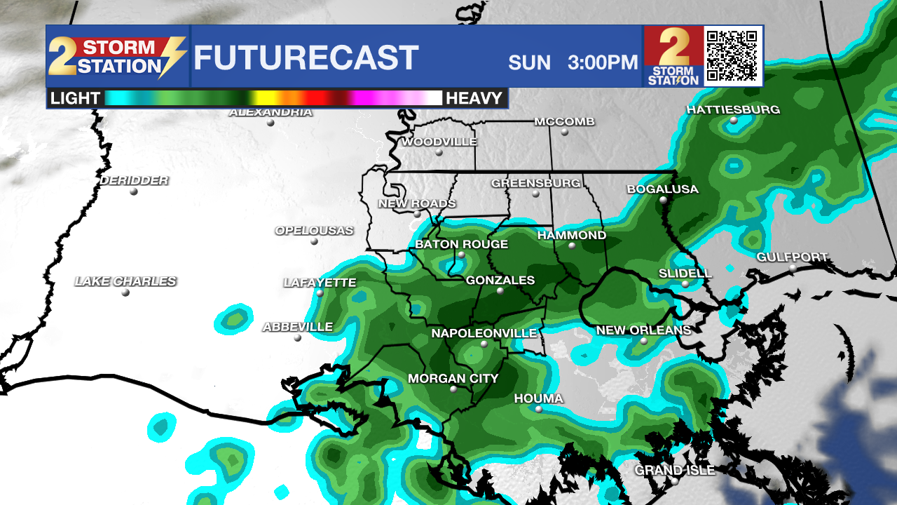
Use the slider to advance through the next 24 hours of Futurecast
Up Next: The cold front will move south of the coast by the afternoon on Easter Sunday. The holiday will start with lingering showers, but, new to the Storm Station forecast, conditions will trend drier through the day. Don’t expect a ton of sun; clouds will be more stubborn to exit. The big story will be the temperature. That front will switch off humidity and bring in much cooler air as highs will struggle to hit 70°F on Sunday afternoon.
Clouds and that refreshing air will stick around for Monday before the sun and warming temperatures return. After a chilly morning in the upper 40s, the sun will be in full force for Tuesday afternoon. Looking toward the middle of next week, expect a steady climb in temperatures back to the upper 70s. Another weak storm system may bring showers back to the region Wednesday or Thursday, but timing and location are still uncertain—most of the activity could stay offshore.
Get the latest 7-day forecast and real-time weather updates HERE.
Watch live news HERE.
– Josh
The Storm Station is here for you, on every platform. Your weather updates can be found on News 2, wbrz.com, and the WBRZ WX App on your Apple or Android device. Follow WBRZ Weather on Facebook and X for even more weather updates while you are on the go.


.png)

