

Latest Weather Blog
Wednesday AM forecast: Warm, humid, and breezy. Coastal flooding possible
A warming trend continues Wednesday across South Louisiana as breezy conditions develop. While rain chances remain limited, increasing easterly winds will begin to cause issues along the coast.

Today and tonight: Wednesday will be warmer and breezy, with highs climbing into the mid to upper 70s under partly cloudy skies. Winds will be noticeably stronger out of the east, especially closer to the coast, as onshore flow increases. Most areas stay dry, though humidity will begin to creep back up. Tonight will be mild and breezy, with lows in the upper 50s to lower 60s.

Use the slider to advance through the next 24 hours of Futurecast
Up Next: Thursday brings more moisture and slightly higher rain chances, especially along and south of the I-10/12 corridor, where a few isolated showers or storms could develop. The warming trend continues, with temperatures pushing toward the 80s by late week.
Trending News
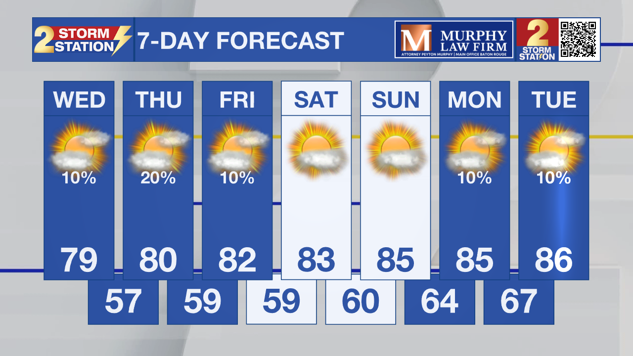
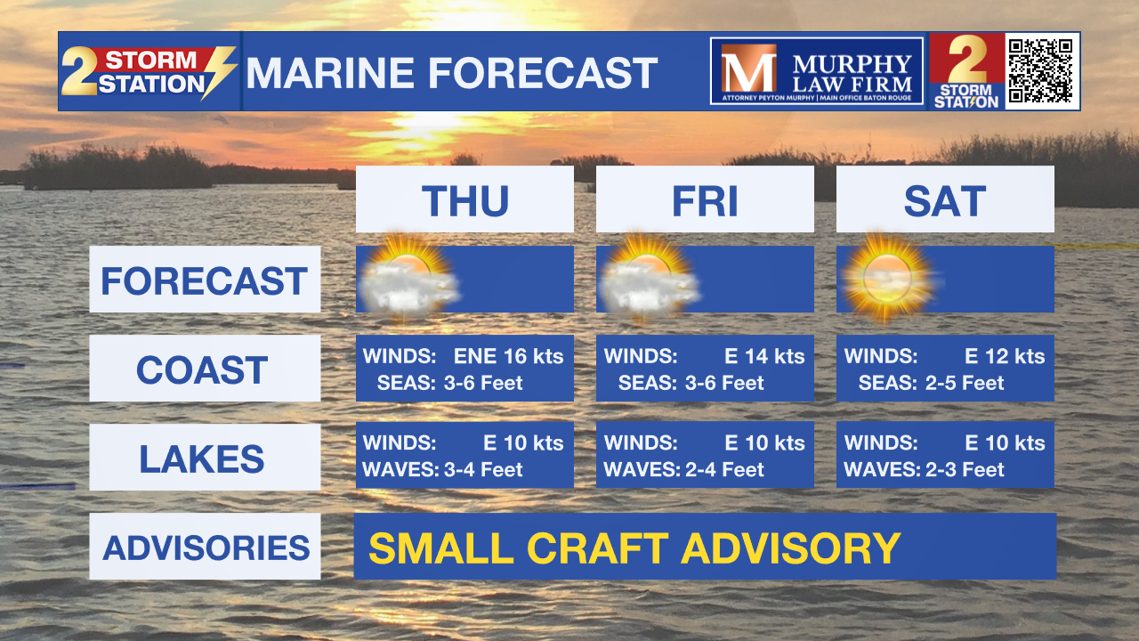
What to look out for: The biggest concern on Wednesday will be strong easterly winds and increasing coastal flooding potential. As winds continue to push water toward the coast, minor coastal flooding is likely during high tide cycles, especially Wednesday afternoon into Thursday.
Get the latest 7-day forecast and real-time weather updates HERE.
Watch live news HERE.
– Dave
The Storm Station is here for you, on every platform. Your weather updates can be found on News 2, wbrz.com, and the WBRZ WX App on your Apple or Android device. Follow WBRZ Weather on Facebook and X for even more weather updates while you are on the go.
More News
