

Latest Weather Blog
Sunday PM Forecast: Stepping into a drier, more comfortable stretch of weather
September will kick off quietly. Drier air will bring a more comfortable feel, with most outdoor plans likely spared from rain.
Tonight & Labor Day: What’s left of last week’s meandering front now lingers just offshore, placing much of the area on the dry side of the boundary. The intrusion of lower humidity will allow overnight lows to dip a few more degrees. Baton Rouge will see temperatures settling near 70°, but a few spots (especially north of I-12) could challenge the upper 60s. Except along the coast, the majority will feel the humidity drop a notch or two from the summer standard on Labor Day. That will make the afternoon high in the low 90s feel a little more welcoming. A stray afternoon thunderstorm can’t be ruled out, but most won’t run into one. The lion's share of Labor Day plans should run without interruption.
Up Next: The rest of the week won’t bring too many changes. Look for a high in the low 90s on most afternoons, with morning lows near 70°. Rain will be tough to find. The best shot of seeing a pop-up storm comes on Tuesday as an upper disturbance swings through. But even then, storms appear spotty at best.
In recent days, there were signs of another push of drier, and possibly cooler air, leading into the weekend. That signal now appears to be dwindling in the data. As a result, forecast highs and lows have come up by a few degrees by late week and this weekend. The weekend forecast is now in line with what’s typical for early September — not too hot, not too humid, and a slim chance of an afternoon storm. Even with these changes, the weather still looks pretty good for the home openers on the Bluff and at Tiger Stadium on Saturday.
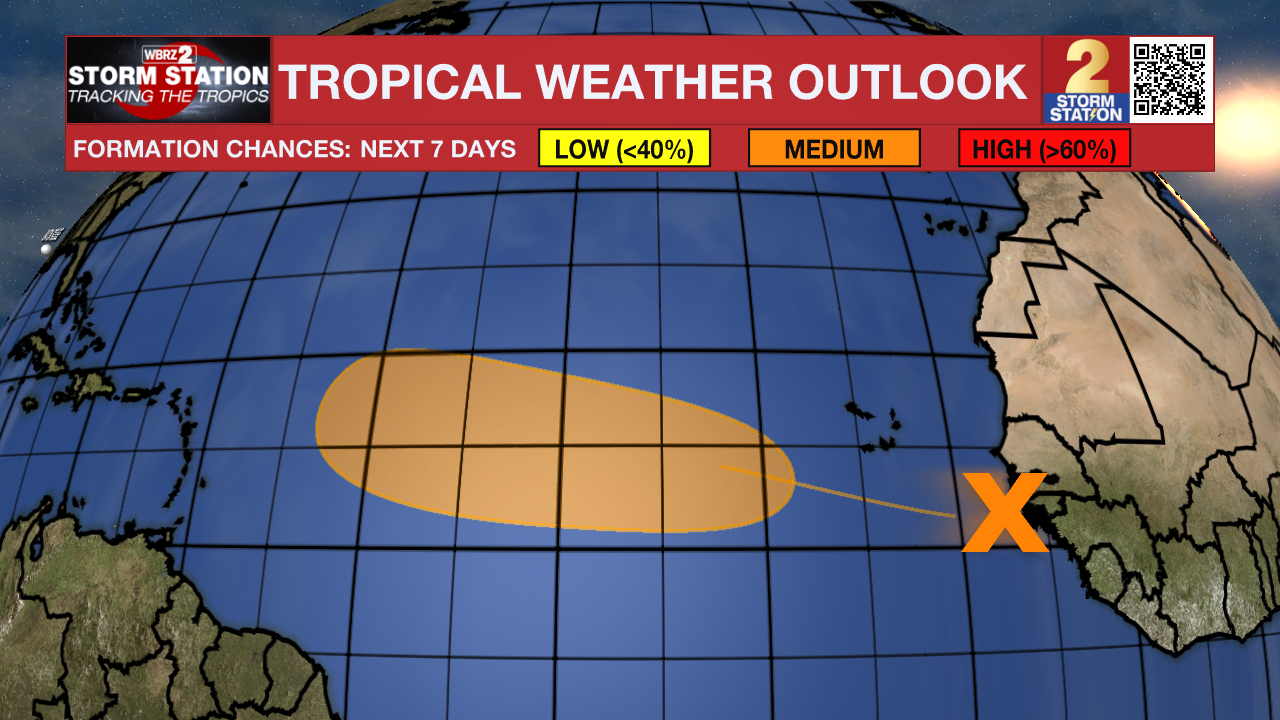
The Tropics: A tropical wave moved off the west coast of Africa on Sunday. Conditions appear favorable for the slow development of this system while moving through the tropics this week. There is a medium (~40%) chance of development in the next seven days. The next name up is Gabrielle.
Trending News
Get the latest 7-day forecast and real-time weather updates HERE.
Watch live news HERE.
— Meteorologist Malcolm Byron
The Storm Station is here for you, on every platform. Your weather updates can be found on News 2, wbrz.com, and the WBRZ WX App on your Apple or Android device. Follow WBRZ Weather on Facebook and X for even more weather updates while you are on the go.
More News
