

Latest Weather Blog
Thursday AM Forecast: Tracking multiple rounds of storms to end the week
Rounds of storms Thursday through Saturday could disrupt commutes and outdoor plans. A few comfortable and slightly cooler days will follow.
Today & Tonight: A line of storms will move into the Capital Area early Thursday morning. As the system pushes east, it will weaken. Early morning commuters should grab their rain gear and prepare for slick roadways. Shower and storm activity will taper off throughout the morning. Look for a mix of sun and clouds this afternoon with a temporary lull in radar activity. Afternoon highs will climb into the middle to upper-80s. Isolated showers and stronger storms may develop this afternoon and early evening, especially in areas north of I-10/12. Downpours will occur with all storms, but a few could contain gusty winds and isolated hailstorms. Conditions will trend drier overnight with lows slipping into the upper-60s by daybreak Friday.
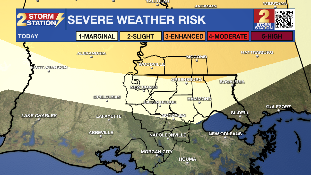
Up Next: Friday will begin dry with occasional sunshine, helping temperatures climb into the mid to upper 80s. By the afternoon, a more energized atmosphere will trigger scattered thunderstorms. A nearby cold front will keep showers and storms going into the evening and overnight hours. These storms will have the potential for producing heavy downpours, gusty winds, and small hail. On Saturday, lingering clouds and moisture will hold temperatures near 80°, with additional showers and possibly a few strong storms. Although it won’t rain the entire time, having rain gear handy will be wise for the first half of the weekend. The cold front will push through late Saturday, clearing out the remaining moisture.
Sunday will be pleasant with dropping humidity levels and clearing skies. Look for lows Sunday morning near 60 degrees with highs around the Capital Region in the upper-70s, closer to 80 degrees in Baton Rouge. Similar conditions will persist Monday before another wave of storms by the middle of next week.
Trending News
River Flooding: The National Weather Service has issued a RIVER FLOOD WARNING for the Mississippi River at Red River Landing, Baton Rouge, Donaldsonville, and Reserve, as well as the Atchafalaya River at Morgan City.
• At Red River Landing, flood stage is at 48 feet. A crest of 59.5 feet is happening now, which is in moderate flood stage. At this level, the east bank levee will be topped, and the prison farmland between the two levees will be inundated. Angola Landing will be under water, closing the ferry there. All river islands along the reach from Red River Landing to Baton Rouge will remain inundated with recreational camps and river bottom farmland under water. This gauge will fall below flood stage around May 14.
• At Baton Rouge, flood stage is 35 feet. Major flooding is already occurring with a crest of 42.4 feet expected today. Around these levels, the grounds of the older part of Louisiana State University's campus become soggy. This includes the area around the Veterinary Medicine building, the Veterinary Medicine Annex, and Alex Box Stadium. Levees protect the city of Baton Rouge and the main LSU campus at this level. Caution is urged when walking near riverbanks. This gauge will fall below flood stage around May 11.

• At Donaldsonville, the flood stage is at 27 feet. Moderate flooding is already occurring. A crest of 31 feet is expected in the next day or so. Around these levels, navigation becomes difficult for smaller river craft. Safety precautions for river traffic are urged. After cresting, the river will fall below flood stage around May 10.
• At Reserve, flood stage is at 22 feet. Minor flooding is already occurring. A crest of 23.8 feet is expected in the next day or so. Around these levels, slow-bell procedures will be enacted for river transportation. After cresting, the river will fall below flood stage around May 9.
• At Morgan City, flood stage is at 6 feet. A crest in minor flood stage at 6.5 feet is happening now. Levels are expected to remain steady through the weekend. At 6 feet, the city dock will be under water. Water will cover the lower end of Belleview Front Street in Berwick. Vessel traffic will be affected by stronger river currents. Vessel traffic safety rules will be strictly enforced by the U.S. Coast Guard. The river will fall below flood stage around May 9.
Get the latest 7-day forecast and real-time weather updates HERE.
Watch live news HERE.
- Emma Kate C.
The Storm Station is here for you, on every platform. Your weather updates can be found on News 2, wbrz.com, and the WBRZ WX App on your Apple or Android device. Follow WBRZ Weather on Facebook and X for even more weather updates while you are on the go.
More News
